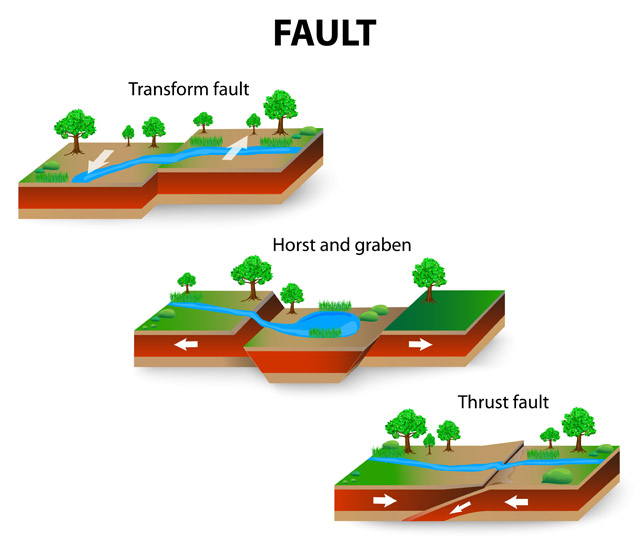
Geophysics uses soil resistivity meters
to characterize the geology
for mining, environmental investigations, archaeology, and other engineering applications. In contrast to geophysical methods used for power plants, substations, and terminals, the geophysical methods implemented to create electrical resistivity images of the subsurface utilize a soil resistivity meter (more commonly called an earth resistivity meter in this application) that acquires an extraordinary number of apparent resistivity measurements.
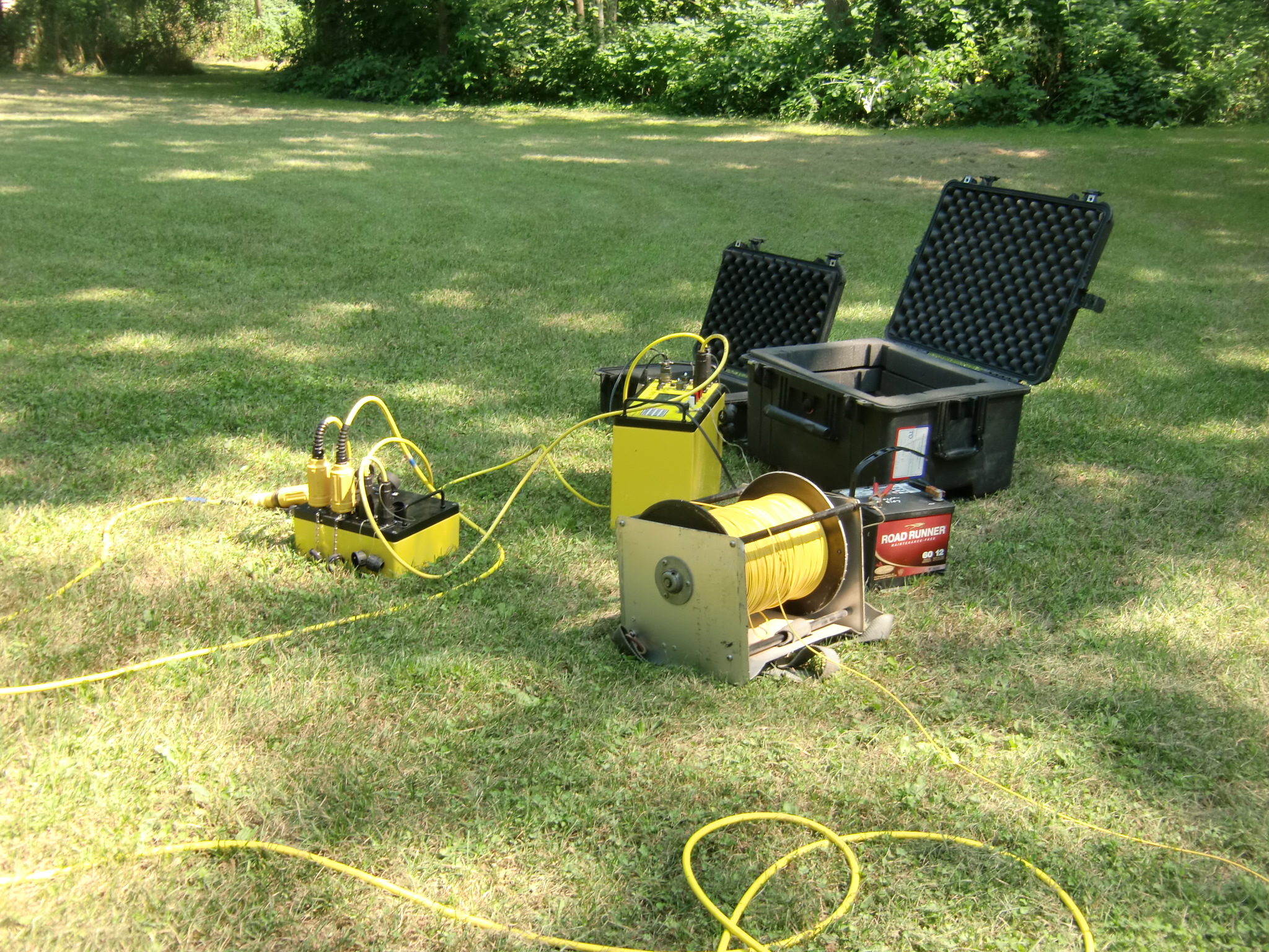
In geologic characterizations, the resistivity measurements are not simply collected to determine how well current flows through the soils, the measurements are needed to create geologic representations of the conditions at depth. In geophysics, models generated from more electrical resistivity measurements are usually better representations than resistivity images created from fewer measurements. Based on this observation, manufactures (like AGI’s SuperSting) created an earth resistivity meter using a multi-electrode resistivity system to collect 1000’s of apparent resistivity values along a resistivity line. Detailed mathematics and algorithms are buried in the geophysics and utilized in software like EarthImager or Res2DInv. EarthImager and Res2Dinv use the electrical resistivity measurements to create a resistivity image or model that is expected to
resemble the subsurface in a geologic cross-section. The cross-section can then be interpreted to locate geologic units, groundwater, soil contamination, and even graves. The depth of investigation is dependent on the electrode spacing and overall length of the resistivity array. Closely spaced electrodes, on the order of 1 to 2 feet, can be used to map gravel units that are preferential paths in a levee or to locate a small area of fill. Large electrode spacings on the order of 10’s of feet are used to geophysically investigate 100’s of feet below ground. While the theory behind the geophysics used to map the subsurface using electrical resistivity methods is well defined, it takes a powerful resistivity meter to acquire good data that is repeatable and suitable for modeling. There are drawbacks. The geophysics behind the methods tells us that resolution will be lost with increasing depth, simply because the volume of material influencing the apparent resistivity measurements increases with depth. A second issue comes with the fact that models do not have unique solutions. With this in mind, as with any good geophysics program, one should consider alternative engineering geophysical methods.